
Top 10 Day Hikes in the Picos de Europa
The Picos de Europa… Spain’s hidden gem. Full of thrilling hikes taking you through lakes and valleys into high peaks.
Who is this for?
This article is for anyone of all levels! There are hikes of ranging difficulties, all with levels from easy to difficult stated as well as the rough time it should take. Be sure to check the weather before going and hopefully you will have a great time!
What to bring
Approx. 1.5 - 2 litres of water (depending on the hike and temperature)
Waterproofs (check the weather, I would recommend always bringing a rain jacket, you never know what the British weather will bring!)
Snacks and energy bars
Maps (either GPS maps such as Alltrails or printed OS maps), see my hiking guide on the Picos de Europa


1. Ruta del Cares
Length (loop) - 21.4km ( 13.3miles)
Elevation - 1,700m (loop)
Difficulty - Easy
Hiking time - approx. 10 hours
Start: Poncebos or Cain de Valdeon
Restaurants - see map below!
Highlight of the trail
The dramatic gorge scenery, with the path carved into steep cliffs offering stunning views of the Cares River below. as well as the series of narrow tunnels and bridges that add an adventurous element to this iconic hike.
Weather and map linked below!


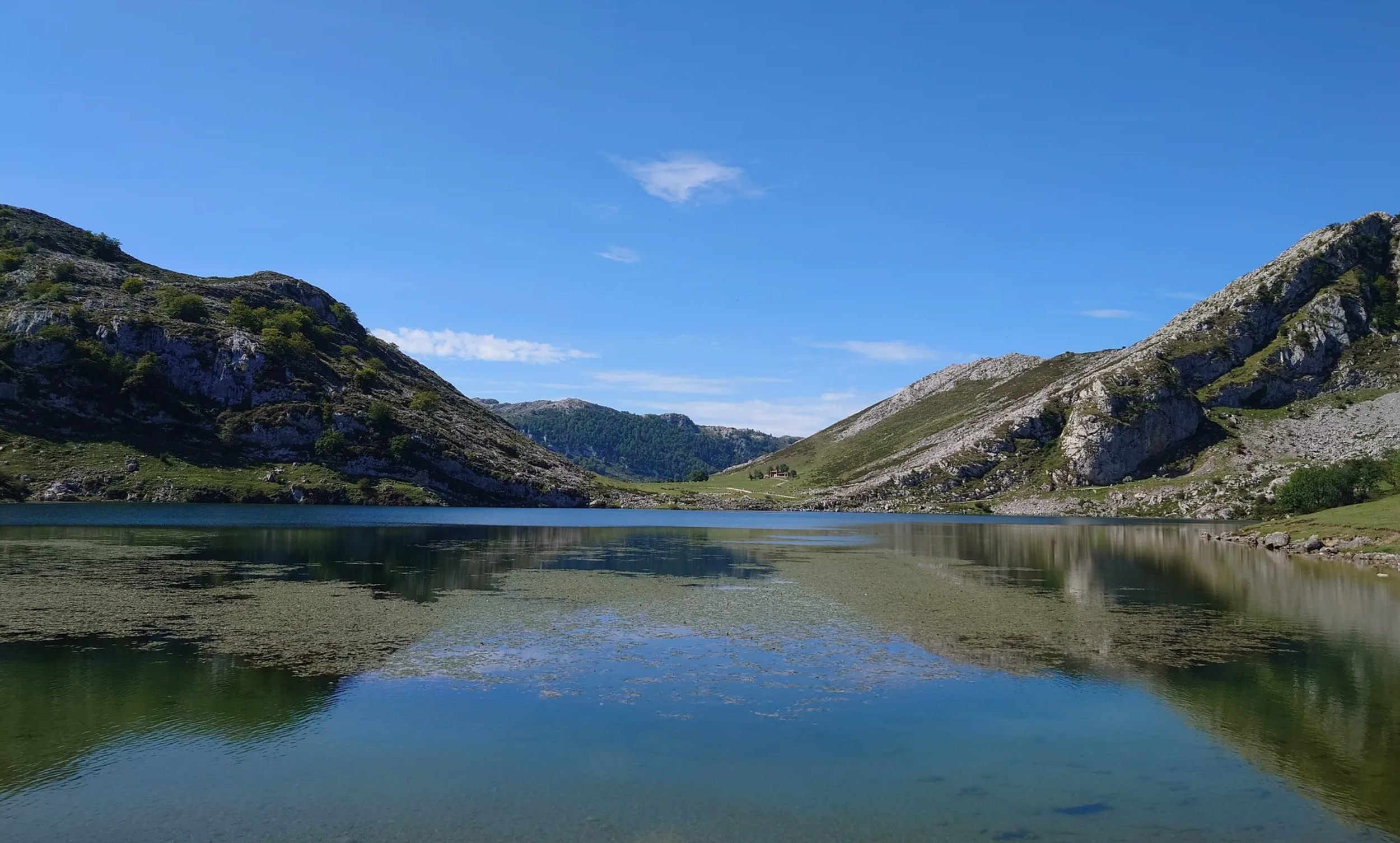
2. Lagos de Cavadonga Circular
Length - 5.5km (3.4 miles)
Elevation - 190m
Difficulty - Easy
Hiking time - approx. 2 hours
Start: Parking Buferrera
Restaurants - see map below!
Highlight of the trail
The serene beauty of the glacial lakes, Enol and Ercina, reflecting the surrounding peaks and lush meadows. as well as the historical Sanctuary of Covadonga, offering a blend of natural beauty and cultural significance.
Weather and map linked below!


3. PR-PNPE 24 Puertos de Áliva
Length - 13.7km (8.5 miles)
Elevation - 340m
Difficulty - Moderate
Hiking time - approx. 5 hours
Start: Fuente Dé
Restaurants - see map below!
Highlight of the trail
The PR-PNPE 24 Puertos de Áliva trail leads hikers through rolling pastures and alpine meadows, surrounded by the majestic peaks of the Picos de Europa. The route passes by the historic Áliva refuge, offering expansive views of both the Cantabrian mountains and the green valleys below.
Weather and map linked below!


4. PR-PNPE 23 Horcados Rojos
Length - 11.0km (6.9 miles) - cable car included
Elevation - 770m
Difficulty - Moderate (difficult when wet)
Hiking time - approx. 4 hours 30 minutes
Start: Fuente Dé (cable car optional)
Restaurants - see map below!
Highlight of the trail
The PR-PNPE 23 Horcados Rojos trail ascends through dramatic, rocky landscapes, offering stunning views of the surrounding cliffs and valleys. The hike culminates at the Horcados Rojos viewpoint, where the striking Picu Urriellu and vast Picos de Europa range unfold in an awe-inspiring panorama.
Weather and map linked below!


5. PR-PNPE 5 Buferrera - Ordiales
Length - 23.0km (14.3 miles)
Elevation - 950m
Difficulty - Moderate
Hiking time - approx. 7 hours 30 minutes
Start: Lago Enol
Restaurants - see map below!
Highlight of the trail
The PR-PNPE 5 Buferrera - Ordiales trail guides hikers through the lush meadows and karst landscapes of the Covadonga area. The trail ends at the Ordiales viewpoint, where breathtaking vistas stretch across the surrounding peaks and valleys, offering a sense of solitude and vastness.
Weather and map linked below!

6. PR-PNPE 16 Collado Jermoso
Length - 10.5km (6.2 miles)
Elevation - 1,410m
Difficulty - Hard
Hiking time - approx. 7 hours
Start: Cordiñanes de Valdeón
Restaurants - see map below!
Highlight of the trail
The PR-PNPE 16 Collado Jermoso trail takes hikers through rugged terrain with sweeping views of deep valleys and towering peaks. The route culminates at the Collado Jermoso refuge, perched dramatically on a high ridge, offering one of the best panoramic vistas in the Picos de Europa.
Weather and map linked below!


7. Arroyo de Caneru - La Terenosa - Refugio de Urriellu
Length - 15km (9.3 miles)
Elevation - 1,450m
Difficulty - Difficult
Hiking time - approx. 7 hours 30 minutes
Start: Collado Pandébano
Restaurants - see map below!
Highlight of the trail
The Arroyo de Caneru - La Terenosa - Refugio de Urriellu trail leads hikers through serene meadows and forests, offering beautiful views of the valley below. As the path approaches the Refugio de Urriellu, the striking silhouette of Picu Urriellu dominates the landscape, providing a dramatic backdrop to the journey.
Weather and map linked below!


8. PR-PNPE 27 Brez - Canal de Las Arredondas
Length - 5.3km (3.3 miles)
Elevation - 250m
Difficulty - Moderate
Hiking time - approx. 2 hours
Start: Brez
Restaurants - see map below!
Highlight of the trail
The PR-PNPE 27 Brez - Canal de Las Arredondas trail is a moderate hike that begins in the village of Brez and ascends through the striking Canal de las Arredondas. Along the way, hikers are treated to impressive rock formations and panoramic views of the Picos de Europa's rugged landscapes.
Weather and map linked below!


9. PR-PNPE 25 Vega de Liordes
Length - 13.2km (8.2 miles)
Elevation - 1,070m
Difficulty - Moderate
Hiking time - approx. 6 hours
Start: Fuente Dé
Restaurants - see map below!
Highlight of the trail
The PR-PNPE 25 Vega de Liordes trail is a moderately challenging route that ascends from Fuente Dé to the high plateau of Vega de Liordes. Known for its steep initial climb up the Canal de Pedabejo, the trail rewards hikers with sweeping views of rugged limestone cliffs and the vast Liordes basin.
Weather and map linked below!


10. PR-PNPE 20 Monte Camba
Length - 13.7km (8.5 miles)
Elevation - 695m
Difficulty - Moderate to difficult
Hiking time - approx. 5 hours
Start: Sotres
Restaurants - see map below!
Highlight of the trail
The breathtaking view from the summit, where you can see the majestic Naranjo de Bulnes and surrounding peaks. Another standout is the scenic route through lush beech forests and the picturesque village of Tielve.
Weather and map linked below!
