

Picos de Europa
The Ultimate Hiking Guide!

Why hike in the Picos de Europa?
The Picos de Europa is a stunning mountain range in northern Spain, spanning Asturias, Cantabria, and Castilla y León. Known for their dramatic limestone peaks, deep gorges, and lush valleys, it's a paradise for hikers. The area boasts rich history and culture, including the significant site of Covadonga, linked to the Reconquista. Local cuisine, especially the famous Cabrales cheese, adds to the experience. With welcoming mountain refuges, you can easily extend your adventure overnight. The Picos de Europa offers a perfect blend of natural beauty, adventure, and cultural richness.
Some of my favourite takeways from this beautiful location are:
Quiet and free from tourists - the Picos alloys you to get a glimpse into Spain and Spanish culture free from the mass crowds of tourists that roam the South of the country.
Trails of varrying difficulty - the Picos de Europs consists of peaks of 2,600m+ but also picturesque valleys and diverse wildife. No day will be the same as you will pass through huge variations of landscape in small distances.
Accessible - the Picos contain many refuges, hotels and campsites that can cater for all trips that are reached with relative ease and affordability. See my map on accomodation for more.
Food - the food is varied, delicious and extremely well priced. I was stunned by how much good food I ate everywhere in the Picos!
Why read this guide?
This guide will provide you the resources you will need to plan your trip to the Picos de Europa. This includes hikes of varying lengths and difficulties as well as the multi-day ‘Ruta Circular’ hike I undertook in 2024.
The guide provides important information on accomodation, travel (car or bus), food, when to visit and much more… Scroll down a little and let your imagination take you as you get ready for your next adventure!
Check out my adventure!


Hiking Trails


When to go?
There are a couple of things to keep in mind when deciding when too visit the Picos:
-
May to September
June to August are the peak months with highest temperatures, lowest rainfall and smallest snow coverage in the peaks. The temperature won't often exceed 30C, allowing more comfortable hiking nevertheless.
Hiking in May (as I did) or September can bring mixed weather. Expect more rainfall and slightly cooler temperatures. You will be limited to about 2100m elevation without crampons due to the increased snow on the peaks.
Check out the section 'Weather' for more.
-
Expect the largest crowds to be between June to August.
Particularly popular areas include the Ruta del Cares trail, Fuente De, Potes and the Lakes of Cavadonga. Leaving for the trail early before 8:30am is your best bet to avoid the large groups!
Summer holidays:
End of June to mid September.
Expect larger crowds during these times.
-
May
Lots of availability, no need to book in advance. Refuges are opening from May and most hotels will have plenty of space for you.
June to August
Less availability, and booking in advance will be required especially for refuges where the capacity is much lower.
September
Like May, availability is greater than the peak summer months.
Guided vs Self-guided
One of the first decisions you will be making is whether to get a guide or go self-guided. This chapter will present the pros and cons of both options, give you recommendations of which to choose and suggest companies that offer great guides to make your trip as memorable and enjoyable as possible.
Independent Hiking
Pros
You are most flexible when hiking without a guide. You can go at your own pace, not the pace of a group; you can stop and enjoy a moment at will; you can adapt your hike as best suits you.
Meeting people - whilst the Picos aren’t extremely busy, you will still be able meet other independent hikers along the way, so do not worry about being alone!
More peaceful - I personally go to the mountains for the beauty of stillness, not to be around many people every day.
Popular day hikes like the Ruta del Cares are easily managable without a guide.
Cons
Variable trail marking! FINISH
Requires more planning - you guessed it, doing the trail yourself required you to become familiar with all aspects of the trail including the weather conditions, trail conditions, refuges, camping, water locations etc. I found this out on my trip as a guide that I bumped into in a refuge explained to me not to go beyond 2200m due to the snow conditions (middle of May).
Less aware - guides will explain to you so much about the trail, its history and much more.
Unadvisable for inexperienced hikers - planning such a large trip can be daunting and potentially dangerous if you have never been on a multi-day hike before. Taking a guide will allow you to gain experience and learn tricks of the trail. See my blog for more!
Guided Hiking
Guided tours come in many different forms. Some of the main types include:
Private guides hired per day for your group. Fully customisable tours
Pre-made tours for groups
Pros
Hastle-free - the planning, booking is all done for you, all you need to do is hike!
Many options - there are many forms of guided hiking, from 1-on-1 guides providing you the most personalised and private tour to larger group hikes allowing you to meet new people or travel in a large group fo your friends.
Personalised trips - many tour operators offer highly customisable trips depending on your needs.
Cons
More expensive - depending on many factors such as trip length, luggage transfers… the price may vary, but expect to pay a LOT more than through independent hiking.
Different paces - i have seen groups on my trip where one person was by the far the slowest. This definitely wasn’t the best experience for him, having to be always catching up. Be sure to book a group for you, not a group that will definitely exceed your ability.
Less flexibility - you will spend your hike with the same people from start to finish. Whilst this may be great, I personally love the freedom of meeting new people, camping with my tent and also having some alone time to be with nature and nature alone.
Guided tour companies

Weather
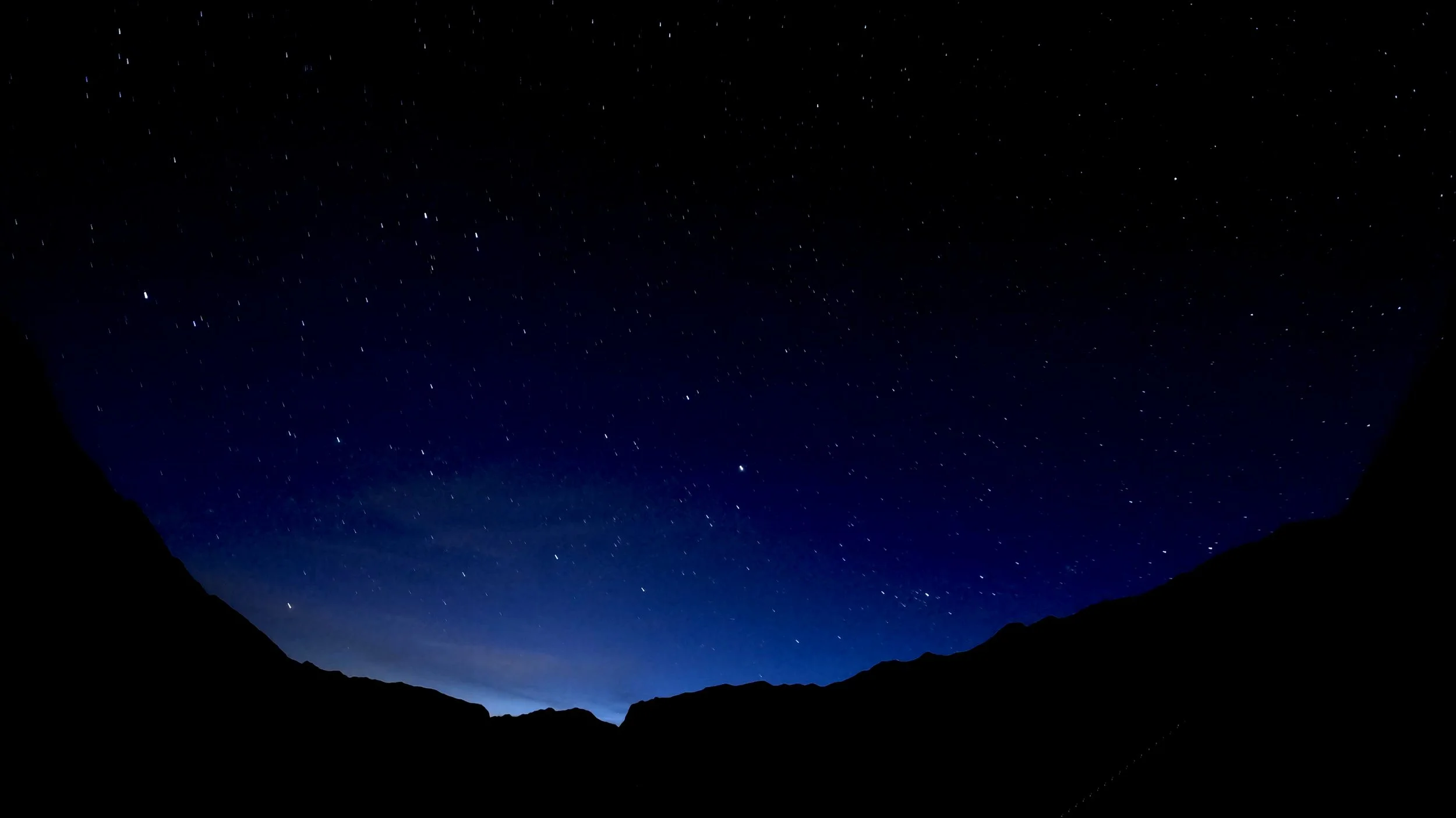
The weather in the Picos de Europa is famously unpredictable, influenced by its complex topography and diverse microclimates. The rapid elevation changes within the mountains cause significant temperature fluctuations and variable weather patterns. Interaction between Atlantic and Mediterranean air masses often leads to sudden and dramatic shifts in weather conditions. Warm, moist air rising over the peaks can cool quickly, leading to unexpected cloud formation, rain, or even snow. This variability makes precise weather forecasting in the region particularly challenging.
Top tip: Never trust the weather forecast more then 24 hours in advance! The weather changes very rapidly, you must be prepared for all weather conditions during your adventure. The day before I started, my weather forecast was predicting 5 days of thunderstorms! Thankfully, that wasn’t the case at all as the weather changed so rapidly for the better :)
Waterproofs (including boots) are essential as well as sun cream, and a cap to protect you from the sun. In general, you won’t need crampons if hiking during the summer months. Winter conditions can be highly unpredictable and only go during the winter if you’re an experienced hiker.
Weather Forecasts
Hiking Trails
Getting to the Picos de Europa
Plane
The closest airports around the Picos de Europa are:
Santander
Distance to the Picos: 130km (80miles)
Bus connections to Potes (and Fuente Dé) from Santander bus station, see below.
Bilbao
Distance to the Picos: 230km (140miles)
Bus connections to Potes (and Fuente Dé) via Santander bus station, see below.
Oviedo
Distance to the Picos: 170km (105miles)
León
Distance to the Picos: 250km (155miles)
Bus
Generally, bus connections are quite limited especially outside of June - August. The easiest way to arrive to the Picos I found is via Santander.
Santander to Potes
Bus operator: Autobuses Palomera
Start: Santander Bus Station — Finish: Potes
Bus timetable:
Santander to Potes: 10:15 - 12:40 | 11:15 - 13:40 | 15:00 - 17:25 | 17:00 - 19:25
Potes to Santander: 07:00 - 09:15 | 08:15 - 10:30 | 09:30 - 11:45 | 16:15 - 18:30 | 18:00 - 20:15
Price: €9.50
How to book: you can buy a ticket on the bus, no need to book in advance.
There is only service to Fuente Dé (24km further from Potes) in the peak summer season in July and August. Outside this time, you can take another bus to Espinama (5km from Fuente Dé) and then walk 30mins. There are only two buses leaving Potes to Espinama every day at 08:15 and 13:15. There is one return bus at 15:00.
Travelling from Bilbao
The bus line to Potes starts at Santoña (approximately 1 hour 30mins away from Bilbao). However, you can take a bus from Bilbao to Santander and then take the bus as above to Potes. The buses between the two cities are operated by Alsa, find out more by clicking the link. They run several services every day.
Oviedo to Arenas de Cabrales
You will have to take two buses for this route as follows:
Oviedo to Cangas de Onis (1hour 30mins)
Bus operator: Alsa - find timetables here
Price: €7,25
Cangas de Onis to Arenas (Cabrales) (35mins)
Bus operator: Alsa - find timetables here
Price: €3,05
León to Cain
There are bus connections to Posada de Valdeón or Caín de Valdeón, however the buses are very infrequent and it is advised to take a car from Leon.
Car
The Picos de Europa is most accessible by car. Cars can be rented at all the airports and major cities (Santander, Oviedo, Gijon, Bilbao etc). Some roads in the Picos are steep and narrow with significant drop offs. If you aren’t fully comfortable driving, check the roads before you depart.
Food and Water
Typical foods
The Pcios de Europa has a rich and varied choice of foods, some of the highlights include:
Cabrales cheese - blue cheese of cow, sheep or goat milk
Fabada Asturiana - Asturian beef stew
Cachopo - breaded and fried beef fillets stuffed with ham and cheese
Canónigo - meringue cake floating in custard
Asturian cider

Cabrales cheese

Fabada Asturiana

Cachopo

Canónigo

Pouring Asturian cider
Menú del día
The menú del día (menu of the day) is a highly affordable an common option served in the Picos de Europa. As part of the menu, you will receive a three course meal and often wine for as little as 12€! Most refuges and hotels will offer you this option; in terms of calories per euro, it doesn’t get much better!
The menú del días that I ate typically consisted of a stew for starter, followed by a beef main and cheescake or other desert. Wine or water was typically the choice of drink, or beer could be paid for seperately.
Supermarkets
Large supermarkets can be found in Potes, 30mins by bus from Fuente Dé. This is a great place to get supplies before heading to the mountains.
Smaller shops can be found dotted around the villages in the mountains, selling a good selection of fruits, vegetables, canned foods, drinks etc. Shops can be found in Espinama (5km from Fuente Dé), Cain de Valdeon, Sotres and Riaño.
Refuges and huts
Whilst huts are typically not serving food, relying on you to bring and make your own food, refuges will typically serve food throughout the day, although it is advised to check when booking. Be sure to check in advance for dietary requirements as the options may be limited in this case.
Menú del día is typically served in refuges, see the section above.
Remember to bring enough cash on your trip as many refuges will only accept this form of payment.
Water
If you are used to hiking in the Alps, the mountains in the Picos do not offer nearly as many glacial streams for you to purify your water. When drinking from a stream, a water filter is useful to make sure the water is safe to drink. Take caution of drinking water close to areas of farmland as there may be an increase in contamination here from the animals.
Water sources are commonly present in villages and towns, but between them, it is recommended not to assume water will be present. Make sure to bring enough water between known water sources.
Public water sources are marked as Fuente on maps, but restaurants and refuges should allow you to fill up as well.
Accomodation
You will find a variety of accomodation within the Picos de Europa, and what you choose will depend on your specific needs and requirements. Below you will find a guide to camping, refuges and hotels / bed and breakfasts.
For booking huts, booking can be done for all huts here
-
Campsites
Campsites are dotted around the national park but are typically accessible with car. The amount of campsites decreases significantly as you leave the roads and ascend up the mountains.
Camping El Redondo (Fuente Dé) - a great base for many day hikes or mulit-day hikes, the campsite contains space for cars or single hikers, has showers, washing machine, a bar and more.
"Unofficial campsites" - I spent one night in Cain de Valdeon in my tent after asking the shopkeeper of the supermarket 'La Ruta' for campsites. I paid 2€ for the night to pitch on the neighbouring field. There is a water tap 100m from the field as well.
Other campsites
Camping Naranjo de Bulnes - Las Arenas
Camping Picos de Europa - Between Arenas de Cabrales and Cangas de Onís
Camping El Cares - Close to the south end of the Cares Gorge
Camping Riaño - Riaño
Camping La Viorna - Potes
Camping San Pelayo - between Potes and Fuente De
-
You are not allowed to camp in the wild. Should you be caught, you will likely be fined.
-
Refuges are a great tool to use, with reasonable prices and great food.
Note, refuges are not open all year round, check before going if you are hiking outside of the summer months.
Complementing the refuges are huts dotted around the mountain. Huts will provide walls and a roof and not much more but are usually free / inexpensive.
Some refuges and huts are listed below:
Central massif:
Cabaña Veronica (open all year)
Western massif:
-
Hotels and B&Bs can be found readily in many towns and small villages.
Summer months: book in advance required as space will be at a premium
Outside of peak season: booking not required.
On my trip in May, many hotels were almost empty!
Packing Advice
Deciding what to pack will vary on the type of hike you are doing. Naturally, day hikes will required significantly less packing than a through hike with a sleep system. Below is advice on what to pack for day hikes or thru hikes.
Day hiking and longer hiking:
Footwear - the most important item you should invest in. Bring a good, quality worn in pair of hiking boots / trail runners. This will prevent blisters, general pain in your legs and will keep your feet warmer and dryer.
Waterproofs - do not expect Mediterranean weather in the Picos de Europa. Rain and snow are common up to May / June with showers to be expected year round.
Water - the Picos de Europa has less natural streams from snow melt than the Alps, therefore you are less likely to be able to filter water this way. Whilst water sources and refuges do offer water, be sure to bring enough water for your hike.
Day hiking:
Bring enough food (lunch and energy bars as necessary) to last you a full day. Adding extra energy bars will not add too much weight to your pack if you want to play safe!
Trekking poles - for steep elevations, trekking poles will reduce the burden on your knees.
Long distance hiking:
Download my suggested packing list for the Ruta Circular multi day hike!

Hiking Trails

Useful Spanish phrases
Don’t expect to be able to use English all around the Picos. Whilst some of the more populated areas may be ok, expect to only speak Spanish at the refuges, small villages and with many local hikers. One of the beauties of the Picos is its lack of international tourism and retained Spanish culture, but this comes with having to know some phrases yourself!
Good day / good morning: buenos días
Good afternoon: buenas tardes
Thank you: gracias
Please: por favor
Bye: adiós
De nada: you’re welcome
Bread: pan
Cheese: queso
Ham: jamón
Water: agua
How much does it cost: cuánto? Or cuánto cuesta?
Do you speak English? : ¿hablas inglés?
Toilet: baño
I’m lost: Estoy perdido
Hiking path: ruta de senderismo
Cash or card: efectivo o tarjeta

Maps and Waymarking
Maps come in two forms: digital or printed. Personally, I like the feel of a printed map as well as knowing its battery won’t die on you. Digital maps have advantages including often a GPS tracker, live weather forecasts and general ease of use and small size compared to a map. However, phones are dependent on battery life, sometimes internet signal and the performance of your phone can vary on a cold night or with heavy rain it may be difficult to use the touchscreen.
Maps require more planning. I to drew my route out with a sharpie. Maps are often bulkier and the often cost between £10 - £20 each. However, self-navigating can be a rewarding and fun process on the trail. Don’t forget a compass too whe using a printed map.
Online Maps:
AllTrails - best trails in the Picos de Europa (click here)
Kamoot - top 20 hikes in the Picos de Europa (click here)
Printed Maps:
The two most useful maps are as follows:
Parque Nacional De Picos De Europa - Macizo Occidental (1:25,000)
Parque Nacional De Picos De Europa - Central y Oriental (1:25,000)
You can buy both here
Waymarking
The quality of the trails is varied. See the photo on the left, all trails from ‘main road’ to ‘track’ are well signposted and easy to follow. Trails labelled ‘secondary track’ to ‘footpath’ have mixed conditions whilst ‘trail’ is often poorly marked.
I would recommending avoiding the ‘trails’ where possible as the path will not be as enjoyable due to its condition.
The photo below shows an example of great trail marking (this is certainly the case on the official routes (GR-202 and PR-PNPE-21 seen here).


Cash or Card
Currency: Euro
Card payment can be used for the following:
Supermarkets
Hotels
Cash is preferred for the following:
Bars and cafes
Refuges in the mountains
Small items such as food and snacks at local shops
ATMs are available in major towns of the Picos de Europa

Phone and Internet
Wifi
Hotels will likely have wifi, but do not expect most refuges to offer the service, espcially in remote locations. Some of the more touristy towns like Cain de Valdeon, Fuente Dé, Potes will offer restaurants with wifi.
Mobile data
Mobile data can be limited as phone masts are not allowed to be installed within the national park. However, I found good mobile data around the towns and villages with a decreasing signal away from the settlements.
Check your phone provider for more information. By searching e.g ‘Vodafone Coverage Map’, you will be able to find out with regards to your provider. Typically, phone signal is good but likely you will not have a coverage entirely during the trail. Check your map for valleys coming up, they are the most likely areas for signal to be lost.
Charging
The standard EU two pin plugs are used in all three countries. You will need an adapter if coming from overseas. Most restaurants / accomodation that I stopped in offered charging, it is readily available along the trail. Consider bringing a portable charger for multiple devices / if camping.
Important tip: often in refuges, everyone wants to use the limited power sockets. So many plugs in a tight space may make the space congested. Often, bulky, large adapters may not fit into a socket. Consider buying a EU charger outright or bringing a power bank to overcome this problem.
Key Contacts and Emergencies
Dial 112 for mountain rescue and ALL general emergencies.
Make sure you have adequate insurance cover. Many insurers specify the maximum elevation they will cover you to. Make sure you are ensured to all elevations on your hike. The maximum elevation at the Picos de Europa is approximately 2650m.
It is advisable to leave a copy of your insurance with a member of family or friend, and take the original with you. EU citizens are eligible to reduced cost (sometimes free) urgent medical treatment through the European Union Health Insurance Card (EHIC) in all three countries. However, payment may be required at the time of treatment, so be adequately insured.

Further References
There are some great ways to get further information regarding the hike! These three resources are where I find out most about any hike, not just for the Picos de Europa.

-
One of my most underrated souces of information, there is a facebook group for any hike out there. In the case of such a popular walk, there are many groups with thousands of members each.
Ask any question, read other questions, other posts, a faebook group is just a trasure trove of informtion. I can guarantee any question will get answered.
In addition, checking groups on the day of hiking can give important updates on the trail condition or anything ese to be aware of.
-
To get a real sense of the feeling of a trail, there is no better site. YouTube offers a unique insight where words on a page simply are not enough. When watching a video, try and look out for things like busyness on trail, the path condition at the time of year and small details like sources of water, streams etc.
Most youtubers (below 10,000) subscribers will answer questions you may well have as well, I certainly do!
Finally, plug for my own video… I’ve tried to express my thoughts and feelings during the video as well as sharing some stunning scenary, so check it out!
-
My go to guides are always Cicerone.
For £10 - £20, the level of detail is second to none. Detailed descriptions of each stage with lots of key facts mean the guide is well well worth it.
You will be able to learn abut the local area’s deep history as well as the geology of the area through this guide.

YouTube is a great source of information, not just my video! ; )